Danny Moore Basin, Axel Peak & Valhalla ridge - Babine Mountain Provincial Park
- Lia Giesbrecht
- Nov 3, 2021
- 2 min read
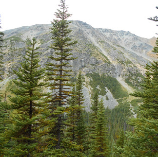
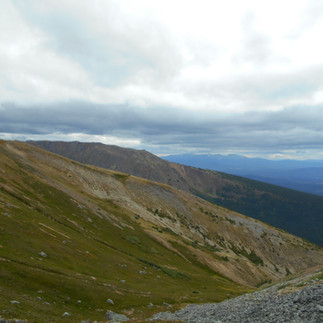
Danny Moore basin trail is off of the Silver King Basin trail. The trail starts literally right after you cross danny moore creek, turn left and you’ll see a faint trail. Its about 3.4km to the creek and another 3km to the lower part of the basin. The trail follows the creek pretty much the whole time. The first bit is steep but beautiful as it winds alongside the creek. So To get to Axel Peak my Dad said we would have to bush whack a little bit lol and he wasn't joking. At the bottom of Danny moore basin you look to the right and see this massive peak that Axel peak on the left is Lagapus mountain. We had to cross over danny moore creek for a third time and headed straight up. Then we hit the shale which was at about 30% grade, hands and feet to get up but amazing views of the basin lagapus and the Galleon at the back end of the basin. We stopped and had lunch close to the top and watched 3 mountain goats. We cut across the saddle at the base of the peak up and over another ridge then headed down into a dry creek bed below Valhalla Ridge. I was feeling pretty done at this point but going down finally felt good. We hiked up to the lower part of Valhalla ridge to try and hook up with the trail that goes back down. We didn’t end up finding it for quite awhile. We again bushwhacked our way down. We did end up finding parts of the trail and random flagging tape but the last part we just decided to head thru the bush and get as close to danny moore creek as we could. We came out a couple of kilometers from the creek. Dad and I we’re both happy to be back on a boring trail. It was a very long day , 19km approx. and 9hrs of hiking. We didn't get back to the truck till 8pm. Lots of yummy blueberries, huckleberries and red currants along the way!!
Note – I would not advise Axel Peak or Valhalla Ridge without someone who’s actually been there.
Directions – To reach the trail head turn off Highway 16 onto Old Babine Lake Road. This is three km east of Smithers or 300 meters east of the Bulkley River Bridge on Hwy 16. Follow BC Parks signs leading to “Driftwood Canyon Provincial Park” where you can stop for a picnic lunch and explore fossil beds. Continue past that park another 5 km to the trailhead parking and information kiosk. The road is gated at that point, with no motorized use beyond. Note that there are several other excellent trails starting in the same area. For more info on these see the BC Parks website http://wlapwww.gov.bc.ca/bcparks/explore/parkpgs/babmtn.htm


Comments